Idaho Hydro-Meteorological Gap Analysis
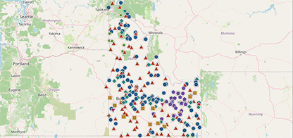
Where Idaho measures its weather, snow, and water — and where it doesn’t. All stations show meet research-grade criteria. Click a site to see its metadata and a link to its source.
Project summary
In 2025–2026, a joint working group from the University of Idaho, Idaho State University, and Boise State University came together to assess gaps in Idaho’s hydrometeorological network.
To add: Additional summary text.
Partner institutions
University of Idaho • Idaho State University • Boise State University
Networks assessed
Agrimet (Bureau of Reclamation) and Snotel (NRCS), plus the wider set of stations meeting research‑grade criteria
Underlying data
Station map scoped to research-grade sites drawn from the Synoptic Data Viewer
Explore the story maps
Three in‑depth analyses, one for each piece of the network. Each opens as its own page with an interactive map and narrative.
Agrimet story map
Evapotranspiration, buffer zones, and Agrimet’s role in the network – with a toggle able NDVI / aridity basemap.
Researchers: Jayashree, Meetpal

Snotel story map
How well Snotel represents Idaho’s snowpack across elevation bands, and how station coverage relates to runoff.
Researchers: Irene, Lejo
Statewide spatial analysis
A co-kriging analysis across every research-grade station: where the network represents Idaho well, and where it falls short.
Researchers: Amber, Sarah
Key takeaways
What each analysis found and why it matters for Idaho’s water.
Agrimet analysis
To add: 2-3 sentences
Snotel analysis
To add: 2-3 sentences
Statewide spatial analysis
To add: 2-3 sentences
What “research-grade” means
Every station on the map above meets research‑grade criteria. Research quality is determined by adherence to World Meteorological Organization standards.
WMO Technical Regulations, Volume I: General Meteorological Standards and Recommended Practices
Selection criteria
- Siting and exposure consistent with WMO guidance for the measured variable
- Documented sensor type, calibration, and maintenance
- Continuous, quality-controlled record with published metadata
- To add: Confirm the specific criteria list with the working group.
To add: Explanatory text on what “Research Grade” means in Idaho specifically.